
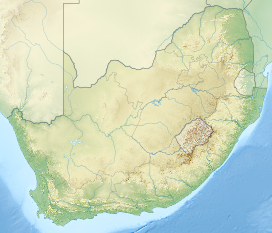
 Bill and I were fortunate to be able to go up Table Rock Mountain on the cableway. It had been raining and windy. After several attempts by our guide we caught a break in the weather. Cape Town is rainy, windy and cold in July. We chose July to go to South Africa because our main goal was to go on safari--Kruger National Park and Karongwe Private Game Reserve. Mosquitos are less of a problem in the cooler dry months of July and August. They are basically dormant. On our trip we saw none until we got to Zimbadwe. There were few there, as well, however we did sleep under the nets at night. We also used deet repellant the entire time. Bill took malerone. I did not. As you can see from the map Cape Town is quite far from the safari area. The weather is dry and warmer in Kruger National Park and Karongwe. It does get cold at night and in the early morning during safari runs. Bring warm clothing to layer.

View of Table Mountain and Cape Town seen from Bloubergstrand. Table Mountain is flanked by Devil's Peak on the left and Lion's Head on the right.
Highest point
Elevation 1,084.6 m (3,558 ft)
Prominence 1,055 m (3,461 ft)
Listing List of mountains in South Africa
Coordinates 33º57'26.33S 18º24'11.19E
Cape Town, South Africa
Geography
Age of rock Silurian/Ordovician
Mountain type Sandstone
Climbing
First ascent António de Saldanha, 1503
Easiest route Platteklip Gorge
 "Table Mountain (Khoikhoi: Hoerikwaggo, Afrikaans: Tafelberg) is a flat-topped mountain forming a prominent landmark overlooking the city of Cape Town in South Africa. It is a significant tourist attraction, with many visitors using the cableway or hiking to the top. The mountain forms part of the Table Mountain National Park. Table Mountain is home to large array of fauna and flora, most of which is endemic.
Features

Table Mountain seen from Lion's Head with low-lying cloud cover over Cape Town.
File:Cape Town under the clouds.webmPlay media
Cape Town under the clouds
The main feature of Table Mountain is the level plateau approximately 3 kilometres (2 mi) from side to side, edged by impressive cliffs. The plateau, flanked by Devil's Peak to the east and by Lion's Head to the west, forms a dramatic backdrop to Cape Town. This broad sweep of mountainous heights, together with Signal Hill, forms the natural amphitheatre of the City Bowl and Table Bay harbour. The highest point on Table Mountain is towards the eastern end of the plateau and is marked by Maclear's Beacon, a stone cairn built in 1865 by Sir Thomas Maclear for trigonometrical survey. It is 1,086 metres (3,563 ft) above sea level, and about 19 metres (62 ft) higher than the cable station at the western end of the plateau.
The cliffs of the main plateau are split by Platteklip Gorge ("Flat Stone Gorge"), which provides an easy and direct ascent to the summit and was the route taken by António de Saldanha on the first recorded ascent of the mountain in 1503.
The flat top of the mountain is often covered by orographic clouds, formed when a south-easterly wind is directed up the mountain's slopes into colder air, where the moisture condenses to form the so-called "table cloth" of cloud. Legend attributes this phenomenon to a smoking contest between the Devil and a local pirate called Van Hunks. When the table cloth is seen, it symbolizes the contest.
Table Mountain is at the northern end of a sandstone mountain range that forms the spine of the Cape Peninsula that terminates approximately 50 km to the south at the Cape of Good Hope and Cape Point. Immediately to the south of Table Mountain is a rugged "plateau" at a somewhat lower elevation than the Table Mountain Plateau (at about 1000 m), called the "Back Table". The "Back Table" extends southwards for approximately 6 km to the Constantia Nek-Hout Bay valley. The Atlantic side of the Back Table, is known as the Twelve Apostles, which extends from Kloof Nek (the saddle between Table Mountain and Lion's Head) to Hout Bay. The eastern side of this portion of the Peninsula's mountain chain, extending from Devil's Peak, the eastern side of Table Mountain (Erica and Fernwood Buttresses), and the Back Table to Constantia Nek, does not have single name, as on the western side. It is better known by the names of the conservation areas on its lower slopes: Groote Schuur Estate, Newlands Forest, Kirstenbosch Botanical Gardens, Cecilia Forest, and Constantia Nek." ...Follow link for the rest of the Wikipedia Article: Table Mountain